
Border history
The interactive map lets you inspect named territories in 3000 BC and compare them to earlier or later snapshots on the timeline.
Ancient historical map
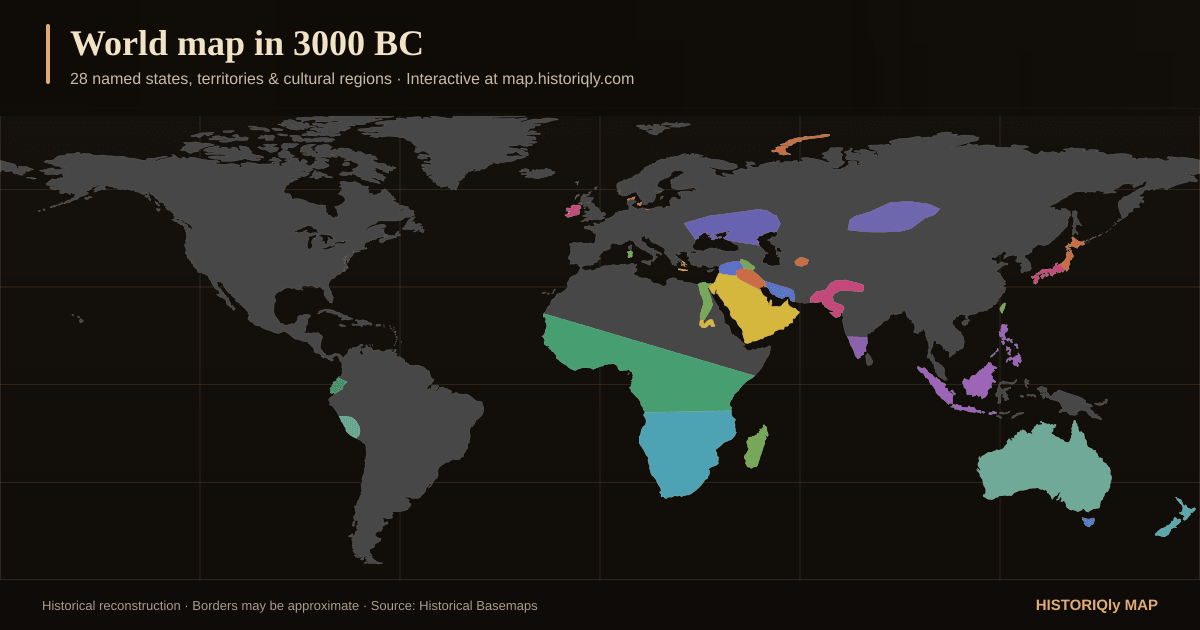
Explore a reconstruction of the world around 3000 BC. Track the rise of early states, river valley kingdoms, and the first territorial empires.
Snapshot at a glance
Counts come directly from this snapshot and the historical layers available in HistorIQly Map.
These names are encoded in the boundary dataset. Inclusion does not settle disputed borders, sovereignty, spelling, or historical interpretation.
What this snapshot shows
The interactive map lets you inspect named territories in 3000 BC and compare them to earlier or later snapshots on the timeline.
Conflicts connected to 3000 BC
These editorial date ranges include 3000 BC. Some records group intermittent campaigns or long-running conflict series, so inclusion does not mean continuous fighting in that exact year.
3100 BC – 2950 BC
Upper Egypt (Narmer) vs Lower Egypt
Egyptian unification was a gradual process associated with Narmer and the First Dynasty, not a single securely documented conquest.
Key battles and events: Formation of the First Dynasty (c. 3100 BC)
Landmarks standing in 3000 BC
Sites already standing (or still being used) in 3000 BC, drawn from the map's landmark layers.
Natural wonder · South America
Highest peak in the Americas and the Southern Hemisphere at 6,961 metres
Built 3000 BC · Europe
Bronze Age settlement preserved under volcanic ash on Santorini
Natural wonder · Asia
Massive volcanic crater in Saudi Arabia's Hejaz region with a white salt flat at its floor
Natural wonder · Asia
Golden Mountains of Siberia where Russia, China, Mongolia, and Kazakhstan meet, a UNESCO biodiversity hotspot
Natural wonder · Asia
Giant sand dune in Kazakhstan that produces a deep humming sound when wind blows across its surface
Natural wonder · South America
Earth's largest tropical rainforest, spanning nine South American nations
Boundary source and context layers
Boundary geometry is adapted from Historical Basemaps, a GPL-3.0 project built for world- and continent-scale historical mapping. The source is a work in progress: pre-modern territories can overlap, borders are often disputed, and a snapshot should be read as a reconstruction around 3000 BC, not as survey-level fact.
The source marks 138 of 138 geometries in this snapshot as approximate.
Conflicts, landmarks, trade routes, and biographies come from separate HistorIQly editorial datasets. They provide discovery context but do not yet expose a citation for every individual record; verify a specific claim with specialist sources before citing it.
Frequently asked questions
The 3000 BC source snapshot reconstructs political borders, territories, and named states for around 3000 BC. You can inspect individual territories, view linked historical figures, and compare this snapshot with nearby years like 2000 BC and 1500 BC.
HistorIQly records whose date ranges include 3000 BC include Unification of Egypt. Long-running entries may represent intermittent campaigns rather than continuous warfare.
HistorIQly features 144 historical figures across all eras. Browse the interactive map to discover people connected to the ancient period.
HistorIQly Map includes 49 historical snapshots spanning from 3000 BC through the modern era, covering the ancient era and every other major period of world history.
Example labels encoded in the 3000 BC source snapshot include Egypt, city-states, Hurrian Kingdoms, Bantu, Khoisan, Semites. These labels and reconstructed boundaries can be approximate or disputed; inspect the map methodology before using them for research.
Nearby years
Related map topics
Historical maps by year
Choose from 49 historical world maps by year. Explore borders, empires, wars, landmarks, trade routes, and people from 3000 BC to the modern era.
Ancient history map
Explore ancient world maps from 3000 BC through the classical era. Follow early civilizations, empires, trade routes, landmarks, and borders.
World history atlas
Browse an interactive world history atlas with maps of empires, wars, trade routes, landmarks, and influential figures from ancient history through the modern era.